Morning walks across the Big Four Bridge, dinner on Spring Street, and sunset river views sound pretty great. If you are thinking about buying near Jeffersonville’s riverfront, you also want a clear plan for flood zones, insurance, and renovation rules. This guide breaks down the lifestyle benefits, the costs to expect, and the steps to take before you write an offer. Let’s dive in.
Why the riverfront draws buyers
Walkable Big Four lifestyle
Living near the bridge puts you right by a top regional amenity. The pedestrian-friendly Big Four Bridge links Jeffersonville and Louisville and anchors a lively park and riverwalk scene. Big Four Station Park hosts community space, and the walkable grid around the bridge feeds into downtown shops and restaurants.
Homes you will find
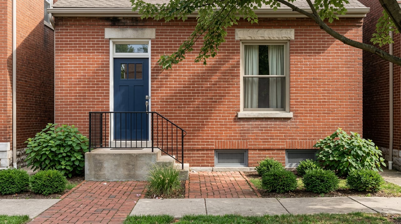
You will see a mix of historic homes and newer infill near downtown. The Old Jeffersonville Historic District includes mid-19th to early-20th-century buildings, and Riverside Drive features older homes oriented to the Ohio River. Expect single-family houses, plus condos and townhomes within easy walking distance of the bridge and riverfront attractions, as outlined by Jeffersonville Main Street’s local overview.
Public investment and demand
City investment in the waterfront, including Big Four Station, marina planning, and streetscape work, has supported demand for living close to the river. Those improvements signal ongoing interest in walkable housing near the bridge landing, which can help sustain premiums for well-located properties, as seen in the city’s project updates.
Flood zones and permits: what to know
Confirm your FEMA zone
Before you fall in love with a view, check the property’s FEMA designation. Use the FEMA Map Service Center to see if the parcel is in a Special Flood Hazard Area (zones that start with A or V). Verify the current FIRM panel and ask for documentation of any Letters of Map Change.
Pull city records
Jeffersonville participates in the NFIP and keeps floodplain permitting records and Elevation Certificates on file. Ask the Building Commissioner’s office for the property’s Elevation Certificate and any floodplain permits so you can understand past work and current compliance. The city’s floodplain page is your starting point.
Plan for renovation rules
If you plan to remodel, learn how the substantial-improvement and substantial-damage rule works. When the cost of work equals or exceeds 50 percent of the building’s pre-improvement market value, the structure must meet current floodplain standards, which can include elevating utilities or flood-resistant construction. Review FEMA’s guidance on SI/SD in publication P-758 for the basics and ask the city whether any past permits triggered this review. See FEMA’s SI/SD guidance.
Insurance and lending basics
When coverage is required
If a property is in an SFHA and you use a federally backed mortgage, your lender will require flood insurance. Some lenders may also require coverage for homes outside mapped SFHAs based on their internal risk rules. Clarify lender requirements early so your closing timeline and budget stay on track.
NFIP vs private options
FEMA’s Risk Rating 2.0 now prices NFIP policies using property-specific risk, such as elevation, distance to water, and foundation type. That makes accurate elevation data even more valuable when you shop quotes. Private flood insurance is also available in many cases and can be competitive depending on the carrier and coverage. Learn how NFIP pricing works from FEMA’s overview of Risk Rating 2.0.
Coverage limits to note
Understand NFIP building and contents limits and the Increased Cost of Compliance benefit, which can contribute funds toward code-required mitigation after qualifying damage. Ask for written quotes that show premiums, limits, and exclusions, and confirm that your lender accepts any private policy you consider. The city’s floodplain page outlines NFIP basics and local contacts.
Pricing near the water
Zillow’s market overview places Jeffersonville’s typical home value in the mid $200,000s, which gives you a broad baseline for comparison. River views, direct access to the riverwalk or Big Four, and limited supply can support premiums, while flood insurance, maintenance, and renovation limits can offset value. Always compare local MLS comps that control for first-floor elevation, condition, and whether any below-grade space is counted as living area. Review price context with Zillow’s Jeffersonville snapshot, then refine with property-specific comps.
Pre-offer checklist
Use this quick list to avoid surprises before you write an offer:
- Confirm FEMA zone and panel. Check the parcel on the FEMA Map Service Center and ask for any Letters of Map Change.
- Request the Elevation Certificate. The city often maintains ECs for SFHA properties. Start with the city floodplain office.
- Ask for flood claim history. Request the seller’s NFIP claim record and any substantial-damage or substantial-improvement actions from city permits.
- Get written flood quotes. Ask for NFIP and at least one private quote using the full address and EC data. See FEMA’s overview of Risk Rating 2.0 to understand pricing drivers.
- Review seller disclosures and permits. Verify whether recent work in the SFHA was permitted and inspected by the City Building Commission.
- Confirm basement coverage. Many NFIP policies limit coverage below grade. Ask insurers to spell out basement limits. See this consumer explainer on what NFIP typically excludes.
- Vet renovation plans. Talk with the city about current freeboard, pre- vs post-FIRM status, and whether your scope could trigger SI/SD. Start at the city’s floodplain resource.
- Check river history. Review the Ohio River gauge near Louisville for past crests and seasonal behavior at the USGS station page.
Condo and townhome tips
If you are comparing units close to the bridge or riverwalk, look closely at how the building handles flood risk.
- Ask for the HOA’s master flood policy and deductibles, plus proof of coverage for common systems.
- Compare unit elevation, parking level design, and where building utilities sit relative to base flood elevation.
- Confirm whether finishes and storage below the first elevated floor are allowed and how they are insured.
- Review any building upgrades such as flood vents, raised mechanicals, or water-resistant materials.
Next steps
Buying near Jeffersonville’s riverfront can deliver a daily lifestyle upgrade if you plan well. Focus on the view and walkability you want, then back it up with firm answers on FEMA mapping, Elevation Certificates, insurance quotes, and city permits. If you want help picking the right block and balancing value against risk, reach out to Weston Faulkner for local guidance and a smooth path to closing.
FAQs
How do I check if a Jeffersonville home is in a flood zone?
- Use the FEMA Map Service Center to look up the exact address and see whether it is in a Special Flood Hazard Area, then confirm the current map panel with your lender and the city.
What is an Elevation Certificate and why does it matter?
- An Elevation Certificate records key elevation data about a structure, which helps price NFIP policies and verify compliance. Ask the City of Jeffersonville’s floodplain office for any EC on file at the floodplain page.
How does Risk Rating 2.0 affect my premium near the river?
- NFIP premiums now reflect property-specific risk such as elevation, distance to water, and foundation type. Getting accurate data often makes quotes more precise. See FEMA’s overview of Risk Rating 2.0.
Are finished basements near the river difficult to insure?
- Many NFIP policies limit coverage for below-grade spaces, including certain finishes and contents. Ask insurers to detail basement coverage and exclusions. Review this consumer explainer on typical NFIP exclusions.
Where can I see historical Ohio River levels for context?
- Check the USGS gauge near Louisville for long-term stage and crest data at the USGS station page.
Do river views always mean a price premium in Jeffersonville?
- Often yes, but the size of the premium depends on elevation, the quality of the view, proximity to the bridge and riverwalk, and any flood history. Start with Zillow’s local snapshot and refine with local comps that control for elevation and condition.